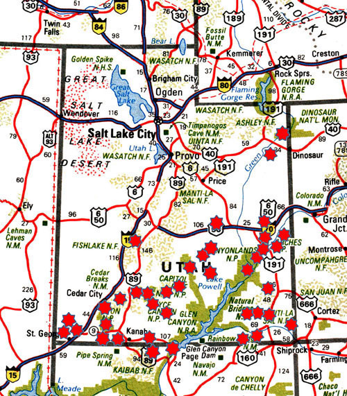
Entfernungen
Anasazi Village StPk
Arches NP
Bryce Canyon NP
Bears Ears NM
Canyonlands NP
Capitol Reef NP
Cedar Breaks NM
Coral Pink Sand Dunes StPk
Coyote Wash
Dead Horse Point StPk
Devils Playground
Dinosaur NM
Edge of the Cedars StPk
Escalante Forest StPk
Fantasy Canyon
Fisher Towers Rec Area
Fremont Indian StPk
Glen Canyon NRA
Goblin Valley StPk
Goosenecks StPk
Grandstaff Canyon
Grand Staircase-Escalante NM *
Hog Canyon
Hovenweep NM
Kanarra Creek
Kane Canyon
Kodachrome Basin StPk
Leprechaun Canyon
Little Egypt Geologic Site
McConkie Ranch Petroglyphs
Mill Creek
Natural Bridges NM
Newspaper Rock StPk
Recapture Pocket
Red Canyon
Red Cliffs Rec Area
Red Mountains Wilderness
San Rafael Swell
Secret Spire
Sego Canyon
Snow Canyon StPk
State Highway 279
Valley of the Gods
Vermilion Cliffs NM
Water Canyon
Witches Rocks
Yant Flat
Yellow Knolls
Zion Canyon NP
GPS-Tracks Utah
